Members View Specific Record Number Scroll down the record
*****SWAAG_ID*****
558
Date Entered
01/07/2012
Updated on
30/08/2012
Recorded by
Will Swales
Category
Vernacular Record
Record Type
General HER
Site Access
Public Access Land
Record Date
01/07/2012
Location
Cogden Moor
Civil Parish
Grinton
Brit. National Grid
SE 055 967
Altitude
350m
Record Name
Boundary stone on Cogden Moor
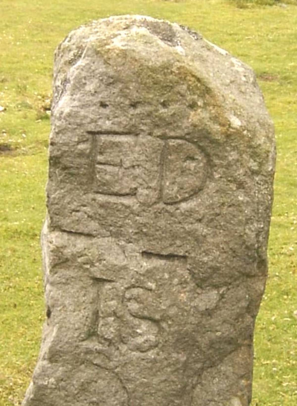
Record Description
GRI-7 – boundary stone number seven of the first 21 around Grinton Parish starting from Stolerston Stile and reaching as far as Gibbon Hill. It is on theboundary between grinton and Ellerton parishes, next to the cattle grid on the Grinton-Leyburn road, near Sharrow Hill. It is inscribed on the south-east face with four dots, ED, two bars, and I+S. ED appears to signify a boundary of the estates of the Erle-Drax family of Ellerton Abbey, which would date the stone to sometime between 1755 and 1887 (see additional notes below). The + symbol between the I and the S is hardly visible but can be seen more clearly on another stone in the series at Record 596. It suggests that I and S relate to two separate family surnames.
Additional Notes
Ellerton Abbey estate was held by people with the surname Erle-Drax from 1755 when it was inherited by Thomas Erle-Drax, the eldest son of Henry Drax and Elizabeth Ernle, heiress to the Erle family estate in Charborough, Dorset. The last person called Erle-Drax to hold Ellerton Abbey, John, died in 1887 leaving the estate to his son Richard, who adopted the splendidly quadruple-barrelled surname Plunkett-Ernle-Erle-Drax, but called himself Richard Drax for short.